Guyana is a small country in located on the carribean coast on northern south america. Nearly all of its small population live on the coast, and mean that exploring the highly undeveloped interior can be a dificult task unless you go in a tour or have a MOUTAINBIKE!!!
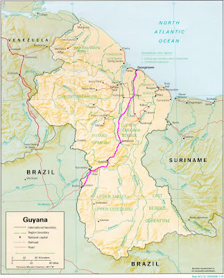
Lethem is on the border with brazil, and the road is 450km of dirt, then a final 100km of pavement linking the town of Linden to georgetown.
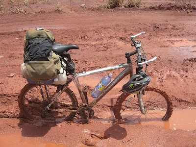
Here is the machine that carried me and my gear - shown in its element.
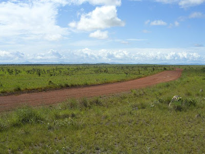
My trip started off like this. A red dirt road winding through a beutiful green sabana lined with hills in the distance.
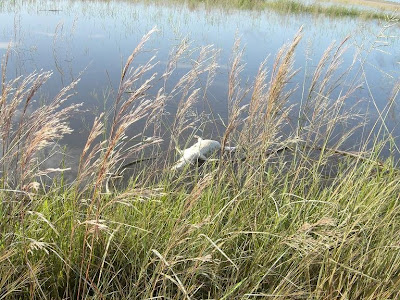
Day 2 took me to an area that was completely flooded by water. The wildlife was amazing and i had crocodiles darting of the side of the road as I cycled past. The dead one above was the only one I managed to get a photo of.
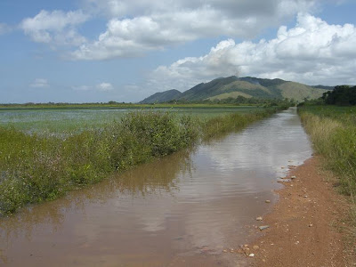
Being the wet season the grassland wasnt the only thing in flood. At times the water was up past my knees and I couldnt pedal. I didnt have to swim though. That was good.
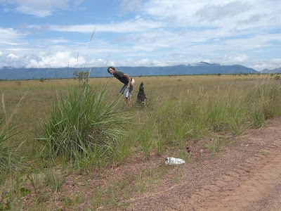
There aint much privacy out in the savana when you need to relieve yourself. Fortunately there is also hardly any traffic on the road. During 150km of savana I was passed by less than 10 vehicles.
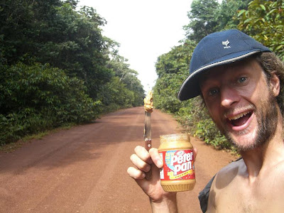
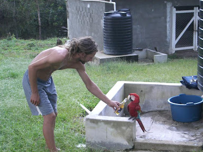
The road then goes through the jungle. Here is me showing one of the best things about Guyana - cheap and readily available peanut butter!!
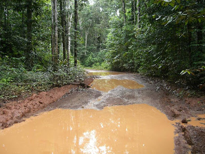
The road through the jungle is incredible. 300km of narrow, muddy, rough road that passes only two small villages and a very small handful of other establishments
Here is me sharing my beer with a new friend. This was one of my stops in the jungle just after crossing the essequibo river by boat. This place was like heaven for me as it had everything i needed to stock up for the rest of my trip.

This was typical acomadation for me. hammock strung up under a roof.
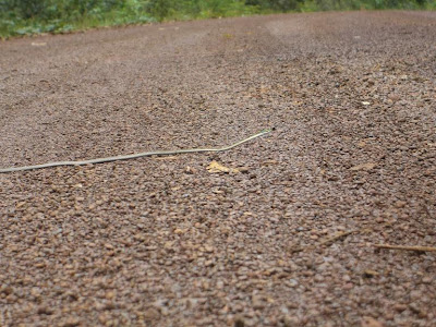
I almost ran straight over this little guy. His tactic must have been to not move so I wouldnt see him. Doesnt work quite as well on the road as it would in the bush.
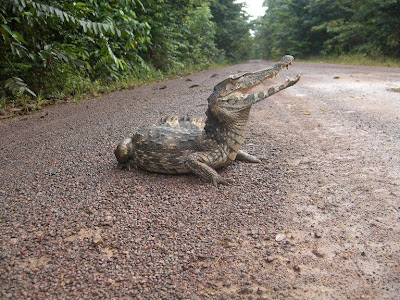
Here is another guy who was hanging out on the road. He wasnt looking very alive, so poked him with a stick and he hissed at me and gave me this great photo pose. Wouldnt move off the road no matter what I did. I was concerned the that the next truck would just run him right over.
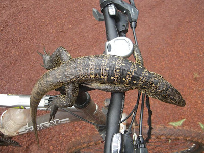
I pimped up my ride.
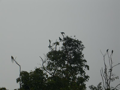
There were heaps of tropical birds around, especially in the mornings, but you hardly ever see them good enough to take decent photos, especially with my little camera. These above are the more wild version of my friend in the photo higher up.
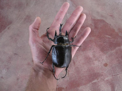
The "pac-man". Yes he was alive and yes i had great trouble removing him from my hand cause as you can imagine, a bug that size can cling on pretty good.
 Lethem is on the border with brazil, and the road is 450km of dirt, then a final 100km of pavement linking the town of Linden to georgetown.
 Here is the machine that carried me and my gear - shown in its element.
 My trip started off like this. A red dirt road winding through a beutiful green sabana lined with hills in the distance.
 Being the wet season the grassland wasnt the only thing in flood. At times the water was up past my knees and I couldnt pedal. I didnt have to swim though. That was good.
 There aint much privacy out in the savana when you need to relieve yourself. Fortunately there is also hardly any traffic on the road. During 150km of savana I was passed by less than 10 vehicles.
 The road through the jungle is incredible. 300km of narrow, muddy, rough road that passes only two small villages and a very small handful of other establishments
 Here is me sharing my beer with a new friend. This was one of my stops in the jungle just after crossing the essequibo river by boat. This place was like heaven for me as it had everything i needed to stock up for the rest of my trip.
 This was typical acomadation for me. hammock strung up under a roof.
 I almost ran straight over this little guy. His tactic must have been to not move so I wouldnt see him. Doesnt work quite as well on the road as it would in the bush.
 Here is another guy who was hanging out on the road. He wasnt looking very alive, so poked him with a stick and he hissed at me and gave me this great photo pose. Wouldnt move off the road no matter what I did. I was concerned the that the next truck would just run him right over.
 I pimped up my ride.
 There were heaps of tropical birds around, especially in the mornings, but you hardly ever see them good enough to take decent photos, especially with my little camera. These above are the more wild version of my friend in the photo higher up.
 The "pac-man". Yes he was alive and yes i had great trouble removing him from my hand cause as you can imagine, a bug that size can cling on pretty good.
 Click on the map if you want a larger view. Its a tourist map of the route showing the tepuis in orange. Not all of the "services" shown on the map were actually there or open.


 There are many waterfalls to see. This was one of the most popular ones, and right beside the road which was good for me. I slept the night in a little hut nearby. The tepuis are seen very clearly in the background.
 Tepui means "house of the gods", and they are the oldest exposed rock formations on the planet. They are known for their unique flora y fauna because they are like forest "islands" because their sheer cliffs rise abruptly 1000m from the surroundings.
 Map of my route through Colombia shown in blue pen.

 And this...there is always plenty of contrast.
 And "dangerous corners"...
 This was one of my most enjoyable rides - an almost 30km downhill into this canyon, then up the other side. It was baking.
 Bucaramanga, Columbias second biggest city. I took this photo partway up the massive 50km uphill.